Titan Images 2022
|
|
|
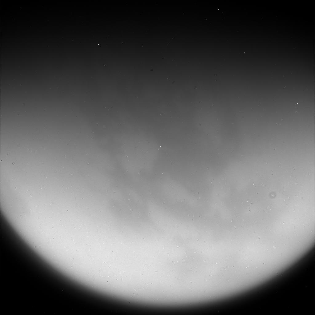
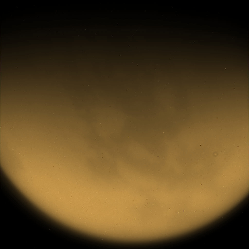
The image in the upper part of the table, whose file name is N00287842.jpg, represents a raw view of Saturn's largest moon Titan acquired on August 27, 2017 with the Narrow-Angle Camera of the Cassini spacecraft. The view was captured on the basis of the CL1 filter and of the CB3 filter. The image had not been validated or calibrated at the time of the observation and a validated or calibrated version was going to be archived with the Planetary Data System proposed by NASA. The image in the lower part of the table represents a colorized version of the original view. Credit for the original view: NASA/JPL-Caltech/Space Science Institute. Credit for the colorization process of the original view: Marc Lafferre, 2022. |
|
|
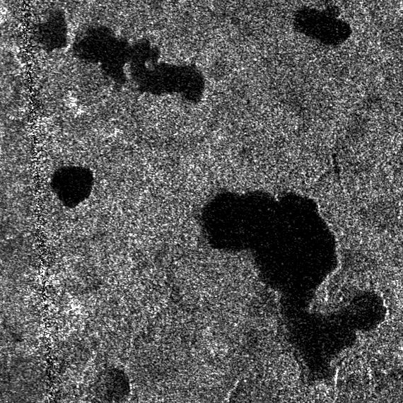
The image above represents a portion of a radar swath obtained during the T-19 Flyby performed by the Cassini spacecraft on October 9, 2006. One can clearly notice several lakes. One of the dark pools is remarkably round or circular. Is that lake related to a cryovolcanic activity or related to a meteoritic impact ? Is there a subsurface layer of liquid methane or liquid ethane in the area ? Each side of the view is approximately 100 kilometers long. The name of the file of the original radar swath is BIFQI69N342_D100_T019S01_V03.jpg. Credit for the original view: PDS Image Atlas. Montage credit: Marc Lafferre, 2022. |
|
|
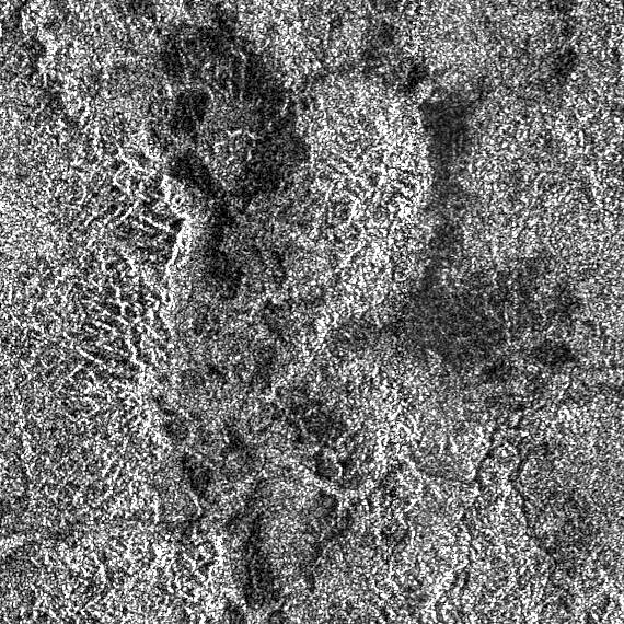
The image above reveals a portion of a radar swath of Titan obtained with the Cassini spacecraft during the T-113 Flyby performed on September 28, 2015. The file name of the original image is BIFQI10S066_D271_T113S01_V02.jpg. Each side of the view represents approximately 100 kilometers. One can notice a relatively complex landscape or topography. Credit for the original view: PDS Image Atlas. Montage credit: Marc Lafferre, 2022. |

|
|
|
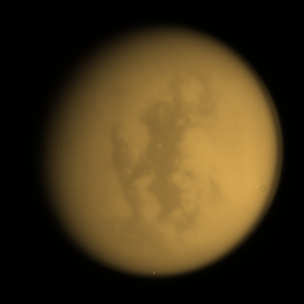
The image in the upper part of this table represents a raw view of Titan acquired from the Cassini spacecraft on December 30, 2015. The view whose file name is N00253698.jpg was captured on the basis of the CL1 filter and of the CB3 filter. The image had not been validated or calibrated at the time of the observation and a validated or calibrated version was going to be archived with the Planetary Data System proposed by NASA. One can notice a sharp contrast between relatively bright areas and relatively dark areas in particular. The image in the lower part of the table represents a colorized version of the original view. Credit for the original view: NASA/JPL-Caltech/Space Science Institute. Credit for the colorization process of the original view: Marc Lafferre, 2022. |
|
|
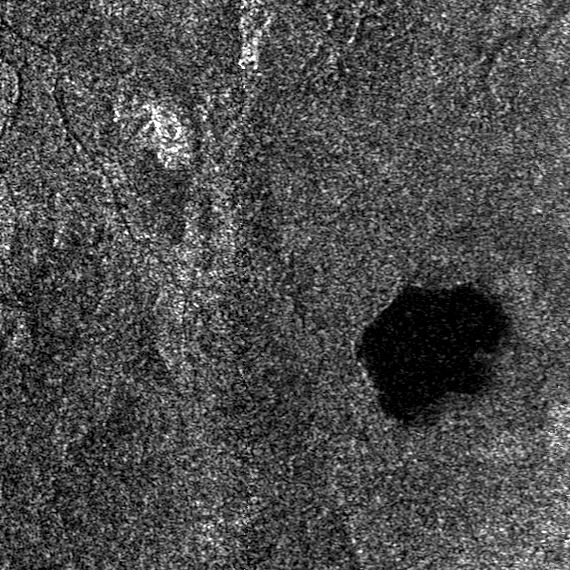
The image above represents a portion of a radar swath of Titan obtained from the Cassini spacecraft during the T126 Flyby of April 21, 2017. The file name of the original radar image is BIFQI64N243_D285_T126S01_V02.jpg. Each side of the portion of the radar swath is about 100 kilometers long. One can notice a relatively round lake which seems relatively isolated even if some drainage channels can be discerned in the area. The maximum length of the lake is approximately 25 kilometers. Is there a cryovolcanic source to that lake ? Is that lake purely related to meteorological phenomena ? Credit for the original image: PDS Image Atlas. Montage credit: Marc Lafferre, 2022. |
Titan Images 2021
Titan Images 2020
Titan Images 2019
Titan Images 2018
Titan Images 2017
Titan Images 2016
Titan Images 2015
Titan Images 2014
Titan Images 2013
Titan Images 2012
Titan Images 2011
Titan Images 2010
Titan Images 2009
Titan Images 2008
Titan Images 2007
Titan Images 2006
Titan Images 2005, 2004
Back to Main Page