Titan Images 2005 and 2004
Cassini Huygens Mission Images
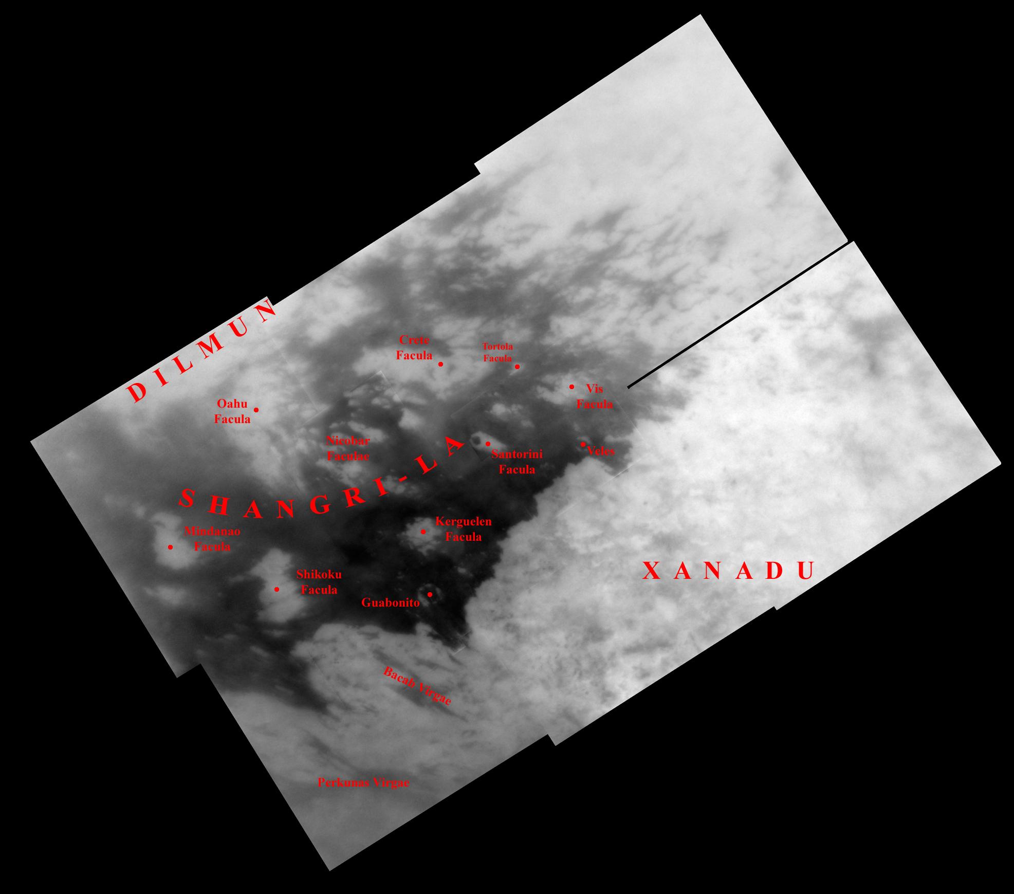 |
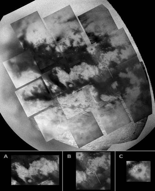
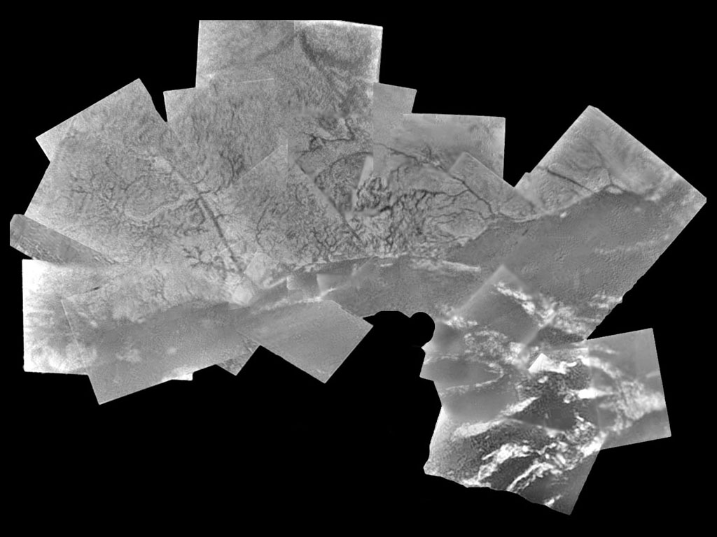
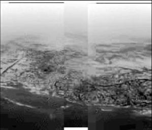
The complex geographic features of Titan have induced scientists to give provisional names to its regions. The mosaic above consists of 10 images captured by Cassini's narrow-angle camera during the Titan flyby of Oct.28, 2005. Each image was processed to enhance surface detail. The mosaic is a high resolution close-up of two contrasting regions: dark Shangri-La and bright Xanadu. This view has a resolution of 1 kilometer ( 0.6 mile ) per pixel and is centered at 2.5 degrees north latitude, 145 degrees west longitude, near the feature called Santorini Facula. It is an orthographic projection, rotated so that north on Titan is up. Image source: NASA, JPL, Space Science Institute |
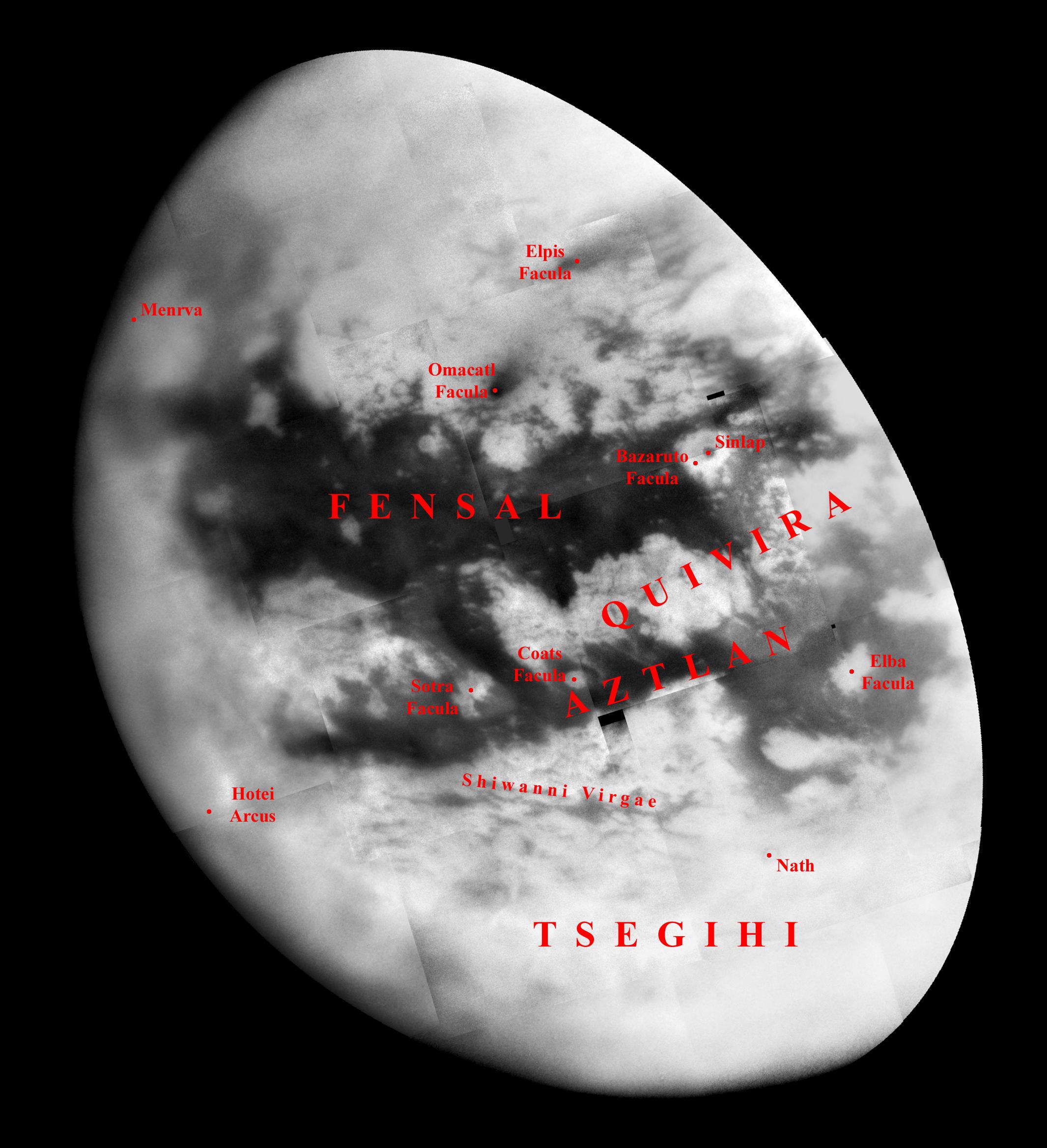 |
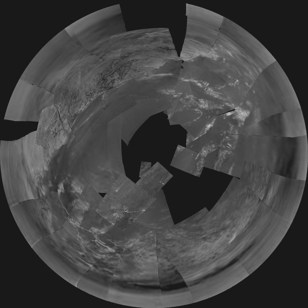
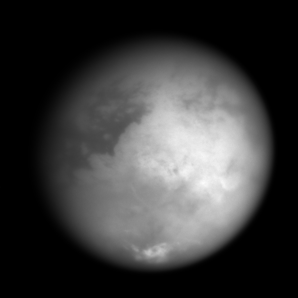
Titan's identity takes shape! This mosaic was created by combining 20 images obtained on Sept.7, 2005 with the spacecraft's narrow-angle camera. Each image was processed to enhance surface detail. The global image unveils more than half of Titan's Saturn-facing hemisphere at moderate resolution, including the Fensal-Aztlan region, formerly "the H." This view is centered at 6.5 degrees north latitude, 20.6 degrees west longitude, and has a pixel scale of about 2 kilometers ( 1 mile ) per pixel. It is an orthographic projection, rotated so that north on Titan is up. Image source: NASA, JPL, Space Science Institute |
 |
This synthetic aperture radar image was captured by the Cassini spacecraft during the ninth Titan flyby and fourth radar pass on Oct.28, 2005. The image is around 300 kilometers ( 186 miles ) by 250 kilometers ( 155 miles ).It is located 10 degrees south latitude and 292 degrees west longitude. A large number of linear and parallel structures can be clearly seen in the south west and in the north east of this landscape. At least 20 dark lines can be identified in the south west.It might be the sign of hydrocarbon or water ice dunes, 2 to 3 km wide and extending over great distances ( hundreds of km ). A second major landscape feature can be spotted: there is a dark region in the upper left of the image which might well reveal a sea of hydrocarbon molecules. The area extends up to more than 60 km with a circular shape around 20 km large and branching channels, 1 to 2 km wide, joining this circular shape. Image source: NASA, JPL |
 |
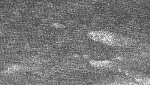
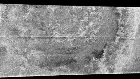
This synthetic aperture radar image of Titan was obtained by the Cassini orbiter during the fourth Titan flyby devoted to radar mapping on Oct.28, 2005. The Cassini spacecraft flew by at a distance of 1,350 kilometers ( 840 miles ). The image is 400 kilometers ( 250 miles ) across and 275 kilometers-wide ( 170 miles ). It is located 8 degrees south latitude and 215 degrees west longitude. The bright patches are likely to correspond to hills, rough terrain or ridges while dark patches are likely to be plains or relatively flat areas. The bright curving feature on the upper left of the image, probably ridges deriving from tectonic activity and deformation from Titan's icy crust, is almost 200 km long. It stretches from left to right and its direction is identical to the direction of the dark streaks above the area. Those streaks are spaced 1 to 2 kilometers apart ( 0.6 to 1 mile ). Are those "cat scratches" related to winds blowing from west to east? Or are they related to internal activity such as a subsurface ocean with streams of liquid methane in eastward direction, for instance? Image source: NASA, JPL |
 |
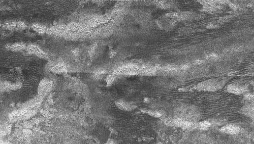
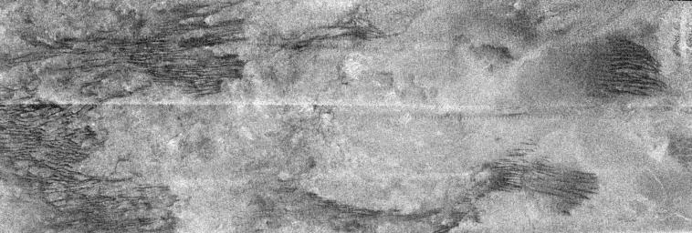
This synthetic aperture radar image of Titan was taken during the ninth Titan flyby and the fourth radar pass on Oct.28, 2005, at a distance of around 1300 kilometers ( 800 miles ). It covers an area roughly 140 kilometers by 200 kilometers ( 120 miles ). It is located 13 degrees south latitude and 300 degrees west longitude. Long dark ridges can be clearly seen on this image. They are parallel and extend over great distances ( 200 km or more ). Those dark streaks, spaced about 1 to 2 kilometers ( 0.6 to 1 miles ) apart, and nicknamed "cat scratches" seem to be very common on Titan.They can be interpreted as dunes drawn by winds blowing from west to east. The bright patches on the image have shapes that also appear to be drawn by winds. Image source: NASA, JPL |
 |
This Synthetic Aperture Radar image was acquired by the Cassini spacecraft during the seventh Titan flyby on Sept.7, 2005, from a distance of about 2,000 kilometers ( 1,250 miles ). The area, which extends over 300 kilometers ( 186 miles ) right to left, is located at about 55 degrees south latitude, 7.5 degrees west longitude. River-like structures are clearly visible in this radar image. The channels are roughly 1 kilometer across ( 0.6 miles ) and perhaps 200 meters deep ( 650 feet ).The canyon-like fracture at the bottom of the image is at least 250 kilometers long ( 156 miles ).The nature of the fluid that generated these deeply-incised channels is still unknown.It might well be ethane, methane or a mixture of ammonia and water. Image source: NASA, JPL |
 |
This Synthetic Aperture Radar image of Titan was captured by the Cassini spacecraft on Sept.7, 2005 during the seventh flyby of this moon.The area is located near 48 degrees south latitude, 14 degrees west longitude and extends around 240 km ( 150 miles ) right to left. The radar image shows a complex network of channels that are variable in width. At the top of the image, one can observe a very well defined groove stretching from a bright area to a dark area. It seems that the bright area is madez up of higher, rougher terrain while dark patches are flatter and more plains-like.The main groove results in many other grooves, forming a branching network. Such patterns are roughly similar to networks formed by rainfall on Earth. It also seems that rougher terrain has been cleansed of organic debris and eroded by methane rainfall, the organic material being driven towards the lower plains where it accumulates. Image source: NASA, JPL |
 |
This Synthetic Aperture Radar image of the surface of Titan was acquired by the Cassini spacecraft on Sept.7, 2005. The image is 175 kilometers high and 330 kilometers wide ( 109 miles by 205 miles ), and is located at 66 degrees south latitude, 356 degrees west longitude in the southern hemisphere of Titan.Two main areas clearly appear on this image. First, one can observe a dark and uniform area, apparently flat, which might well be a sea of hydrocarbon compounds ( ethane, ethane...) or a very wet area. Secondly, there is a bright, rough region on the left side of the image separated from the dark area by what appears to be a well defined shoreline. The bright region is likely high terrain that is cut by channels and bays. Image source: NASA, JLP |
 |
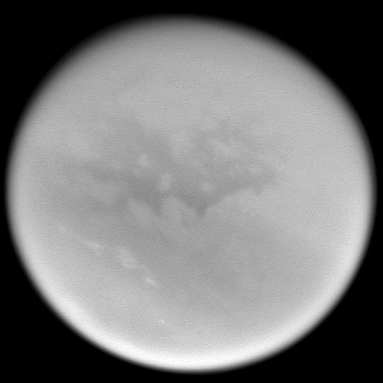
This natural color view of the orange moon was captured by the Cassini spacecraft as it approached Titan on Aug.21, 2005. As usual, Titan's atmosphere is completely opaque in visible light. This color view was obtained by combining images taken with the wide-angle camera using red, green and blue spectral filters. The images were acquired at a distance of approximately 213,000 kilometers ( 132,000 miles ) from Titan and at a Sun-Titan-spacecraft, or phase, angle of 55 degrees. Resolution in the image is about 13 kilometers ( 8 miles ) per pixel. Image source: NASA, JPL |
 |
The image above shows, close to its center, a dark patch, around 234 kilometers long with well defined boundaries, in the south polar region where it is currently summer.The low reflectivity of this feature makes some planetologists suggest that it might represent a methane lake. The image is a composite of three Cassini spacecraft narrow-angle camera images, taken over several minutes during Cassini's distant flyby on June 6, 2005. The images were combined to produce a sharper view of Titan's surface and were taken using a combination of spectral filters sensitive to wavelengths of polarized infrared light. They were acquired from approximately 450,000 kilometers ( 279,000 miles ) from Titan. Resolution in the scene is approximately 3 kilometers ( 2 miles ) per pixel. The view has been contrast-enhanced to improve the overall visibility of surface features. Image source: NASA, JPL |
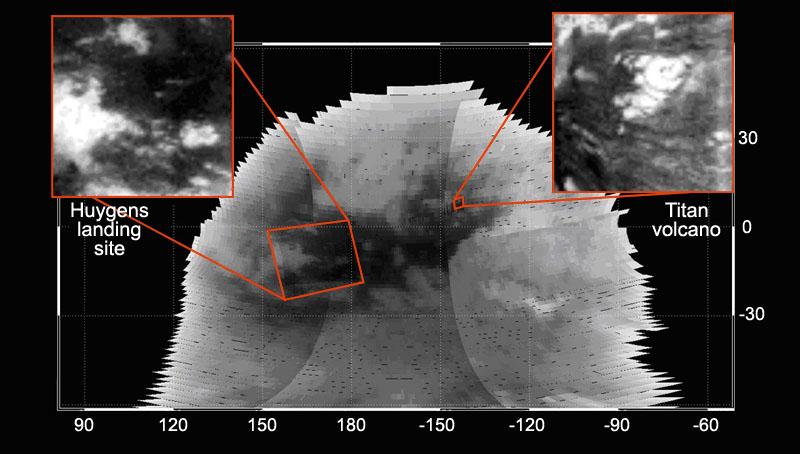 |
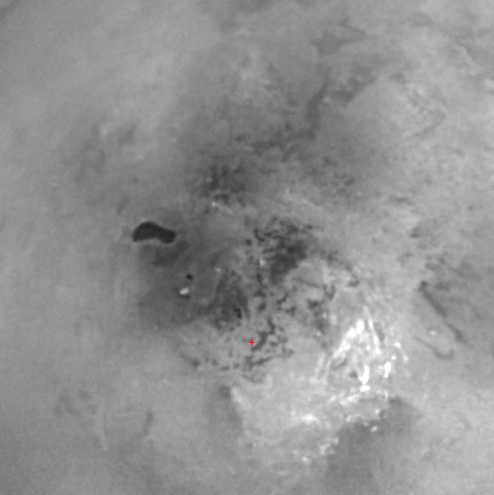
This image above was taken during the Titan flyby on October 26, 2004 by the VIMS instrument onboard the Cassini orbiter.It shows the dark area in which the Huygens spacecraft landed on January 14,2005.On the upper right of the dark area lies what appears to be an ice volcano or cryovolcano taking the shape of a dome, with a black pit in the center and with wings of frozen lava beyond the limits of the dome. Image source: NASA, JPL |
 |
This new mosaic of images is a stereographic projection of Descent Imager / Spectral Radiometer images from the European Space Agency's Huygens probe, taken on January. 14, 2005.It combines 60 images in 31 triplets, from an altitude of 3000 meters. Image source: ESA |
 |
This mosaic was obtained during the close flyby of Titan on March 31, 2005 by the Cassini's cameras.The region imaged lies on the right of the bright Xanadu region.It is composed of several frames taken by the narrow-angle camera ( smaller frames ) put together with an image taken by the wide angle camera filling in the background.The Cassini spacecraft narrow-angle camera images were taken using a filter sensitive to wavelengths of polarized infrared light and were acquired at distances ranging from approximately 148,300 to 112,800 kilometers ( 92,100 to 70,100 miles ) from Titan. Image source: NASA, CICLOPS |
 |
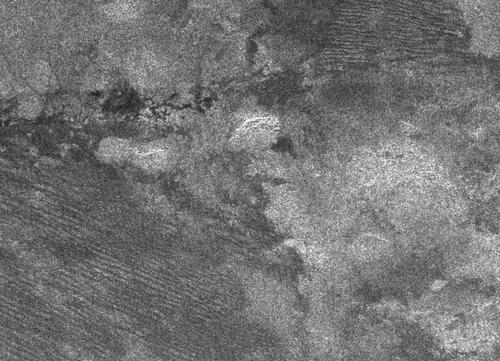
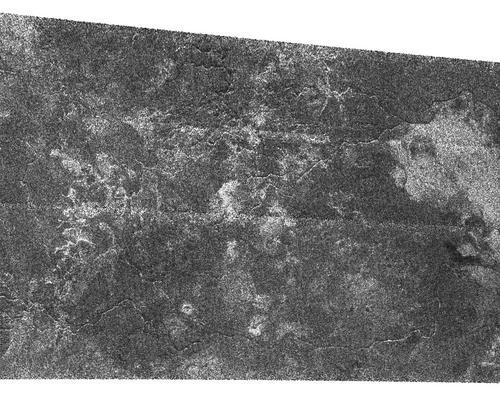
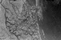
This radar image of Titan was taken by the Cassini radar mapper during the third close flyby of Titan on February 15, 2005.The frame, measuring about 300 kilometers ( 186 miles ) from top to bottom, shows an area near the northeast corner of the optically bright region named Xanadu.Striking characteristics, never seen before, appear in this landscape.In this relatively bright environment, apparently free of impact craters, one can observe numerous dark linear features roughly orientated towards the same direction.Sand dunes driven by west east winds, broken ice structures on a liquid layer, grooves made up of some kind of fuid, cryovolcanism or even an exotic vegetation?Anyway, nobody brings a satisfying explanation to this enigmatic phenomena. Image source: NASA |
 |
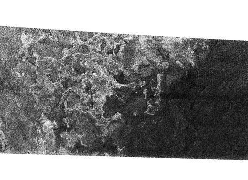
This radar image of the surface of Titan was taken by the radar mapper of the Cassini spacecraft during the third very close flyby of Titan on February 15, 2005.It reveals a huge circular feature with a diameter of approximately 440 kilometers ( 273 miles ).It's almost certain that this is nothing but one of the largest impact craters in the solar system.Up to date, the surface of Titan seems quite young and eroded with very few impact craters contrary to the other satellites of Saturn. Image source: NASA |
 |
This is a mosaic of 30 panoramic images taken by the Huygens lander on 14 January 2005 as it descended through the thick Titan atmosphere, from around 13 km to around 8 km above the surface.One can clearly observe channels in the bright area ( elevated terrain ) and several cloud formations or fog in the dark, flat area. Image Source: ESA |
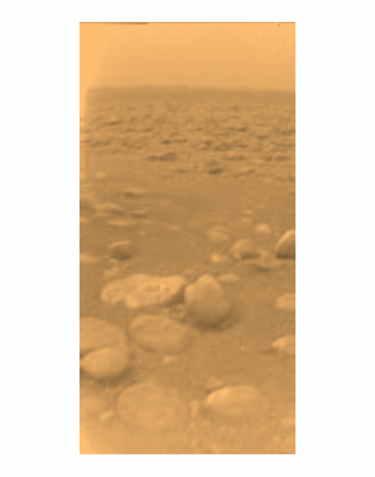 |
This is the first colour image of Titan's surface taken by the Huygens probe on 14 January 2005.At first sight, the Titan landscape is similar to the Martian landscape.But the red colour would not be linked to oxidized iron.The eroded stones might be made up of water and hydrocarbon ice. Image source: ESA |
 |
This composite was taken on January 14, 2005 by the Descent Imager / Spectral Radiometer onboard the Huygens probe during the descent from an altitude of about 8 kilometers.This stunning area of Titan reveals what appear to be hills with a well defined coastline and drainage channels opening into a flat and dark area.This image, comparable to a terrestrial environment such as the French Riviera raises more questions than answers. Image source: ESA, NASA |
 |
This stunning panoramic image of the surface of Titan was taken by the Huygens spacecraft on 14 January 2005 as it plunged toward the most enigmatic environment in the Solar System, around 16.2 km above the soil.The image was beyond the expectations of most planetologists: channels, a shoreline, an ocean like area and clouds in the dark area. Image source: ESA |
 |
This infrared image was taken on December.13,2004 during the second Cassini Huygens flyby.It shows linear cloud features at mid latitude between the equator and the south pole.Those cirrus like formations were not present in the first flyby on October.26, 2004. Image sources: NASA / JPL |
 |
Titan in False Color October. 27,2004 This image is constructed from 4 images acquired through different color filters.It includes part of the ultraviolet and infrared.The blue is from an ultraviolet color and shows the high atmosphere and detached hazes.The bright region in the center of the image has been named Xanadu.Cloud formations in the south pole are clearly visible through infrared wavelengths. Image: NASA, CICLOPS |
 |
This Titan image, showing the bright "continent-sized" terrain known as Xanadu, was acquired on October.25, 2004 with the narrow angle camera through a spectral filter centered at 938 nm, a wavelenght area at which Titan's surface can be mostly easily detected. Image: CICLOPS |
 |
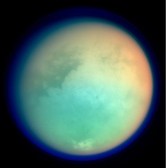
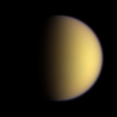
This not quite true color image was taken on July.2,2004 from 789,000 km away with a phase angle of 114 degrees.It has additional color information from the ultraviolet part of the spectrum in order to show Titan's detached haze layer which appears in purple on this image. Image sources: NASA / JPL / CICLOPS |
 |
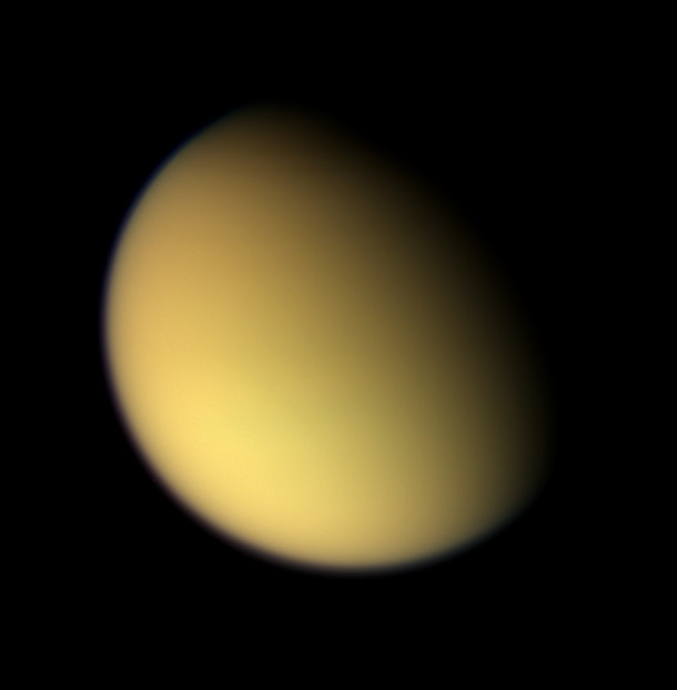
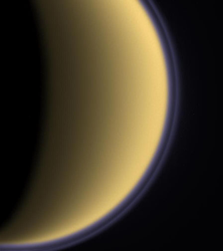
This true color image from Cassini taken at a distance of 347,000 km on July.2, 2004 shows the hazy orange-red sky for which Titan is famous. Image sources: NASA / JPL / CICLOPS |
Artistic views of Titan
 |
Lightning on Titan This rendering shows flashes of lightning on Titan lowering the opacity of the atmosphere so that the disk of Saturn can be briefly seen through the red haze from the surface of Titan.For a Titanian observer, Saturn appears 11 times larger than the Moon of the Earth as seen from the surface of our planet and Saturn is also much more reflective than our moon with an albedo close to 50% compared to an albedo of 12% for the Satellite of the Earth. Image source: Marc Lafferre, year 2005 |
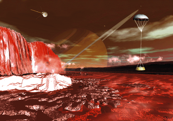 |
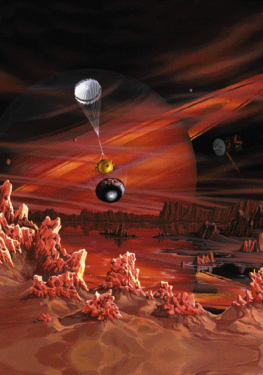
| Artist: David Seal |
 |
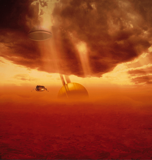
| Artist: Craig Attebery |
 |
| Image © : ESA, Illustration by Medialab |