Titan Images 2017
The image above shows Saturn's tiny moon Epimetheus, the
A and F rings of the Gas Giant as well as the Hazy Moon Titan beyond the
rings and Epimetheus. Epimetheus is far from being spherical since it is
only 116 kilometers or 72 miles across. Titan is by far the largest moon
of Saturn with a diameter reaching approximately 5,150 kilometers or 3,200
miles. The view clearly reveals the Encke gap in the A ring. The Encke gap
appears to be 325 kilometers or 200 miles wide. The Encke gap hosts, in
particular, the tiny moon Pan which is 26 kilometers or 16 miles across.
Features related to the small body can be noticed here. A couple of bright
clumps can be identified as well in the F ring. The image was obtained with the Narrow-Angle Camera of the Cassini spacecraft on August 28, 2006 at a distance of about 667,000 kilometers or 415,000 miles from Epimetheus and 1.8 million kilometers or 1.1 million miles from the Opaque Moon Titan. The illuminated side of the rings shows their beauty in this photo. The color data are artificial in this view. However, the color data, here, are close to what the human eyes would see since the color information is based on red, green and blue views captured at almost the same time and phase angle as the clear filter photo. The color data were overlaid onto the previously released clear filter view in order to be as close as possible to reality in terms of colors. Image Credit: NASA/JPL/Space Science Institute. |
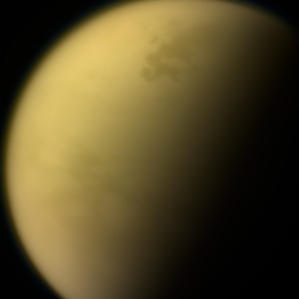
The images above, acquired from the Narrow-Angle Camera
of the Cassini spacecraft on September 13, 2017, reveal Saturn's largest
moon Titan whose atmosphere is completely opaque in the visible spectrum.
The atmosphere of Titan is deeper than our atmosphere and the atmospheric
pressure on the surface of the Orange Moon is largely higher than that of
the Earth at sea level. The view in the upper part of the table
corresponds to a natural color image of Titan composed of views captured
using red, green and blue spectral filters. The haze of hydrocarbons or
organics prevents us from seeing through the atmosphere. As a result, the
atmosphere of Titan is quite uniform in the visible spectrum. The view in
the lower part of the table represents an enhanced-color image of the
Opaque Moon incorporating a separate view obtained using a spectral filter
centered at 938 nanometers. The views in infrared or near-infrared light
reveal surface features of the giant moon. The enhanced-color image allows
us to discern lakes or seas in the high latitudes of the northern
hemisphere. The images were taken at a distance of 481,000 miles or
774,000 kilometers from the Opaque Moon. Those views of Titan are among
the last images captured from the Cassini orbiter and sent back to our
planet since the plunge of the Cassini spacecraft into Saturn's atmosphere
was planned for September 15, 2017.
Image Credit: NASA/JPL-Caltech/Space Science Institute. |
The unprocessed image above, taken from the Cassini
orbiter during the final, distant flyby of the Opaque Moon on September
11, 2017, reveals a portion of Titan's surface. One can discern the
land of lakes, seas and rivers found in the high latitudes of the northern
hemisphere of the dynamic moon. The irregular shape of Kraken Mare, the
largest surface body of liquids on Saturn's largest moon, can be clearly
observed here in particular. The northern hemisphere is currently
experiencing the beginning of the Summer season that is particularly long
on Titan. Image Credit: NASA/JPL-Caltech/Space Science Institute. |
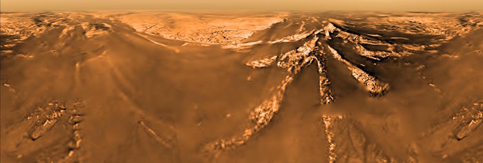
The image above reveals a panoramic view of Titan from an
altitude of 2 kilometers during the historic atmospheric descent of the
Huygens probe on January 14, 2005. The natural color view is shown in
Mercator projection in which the N-S/E-W directions cross at right angles.
Landscape features appear distorted due to the Mercator projection. One
can notice the surprising contrast between a dark, brown area and bright
regions where dark fractures or drainage channels can be discerned. The
bright areas are made of hills or mountains whereas the dark, brown area
can be seen as a plain since it is apparently relatively flat and
uniform. The Huygens probe may have landed onto an ancient brook, stream
or river.
Image Credit: ESA/NASA/JPL/University of Arizona. |
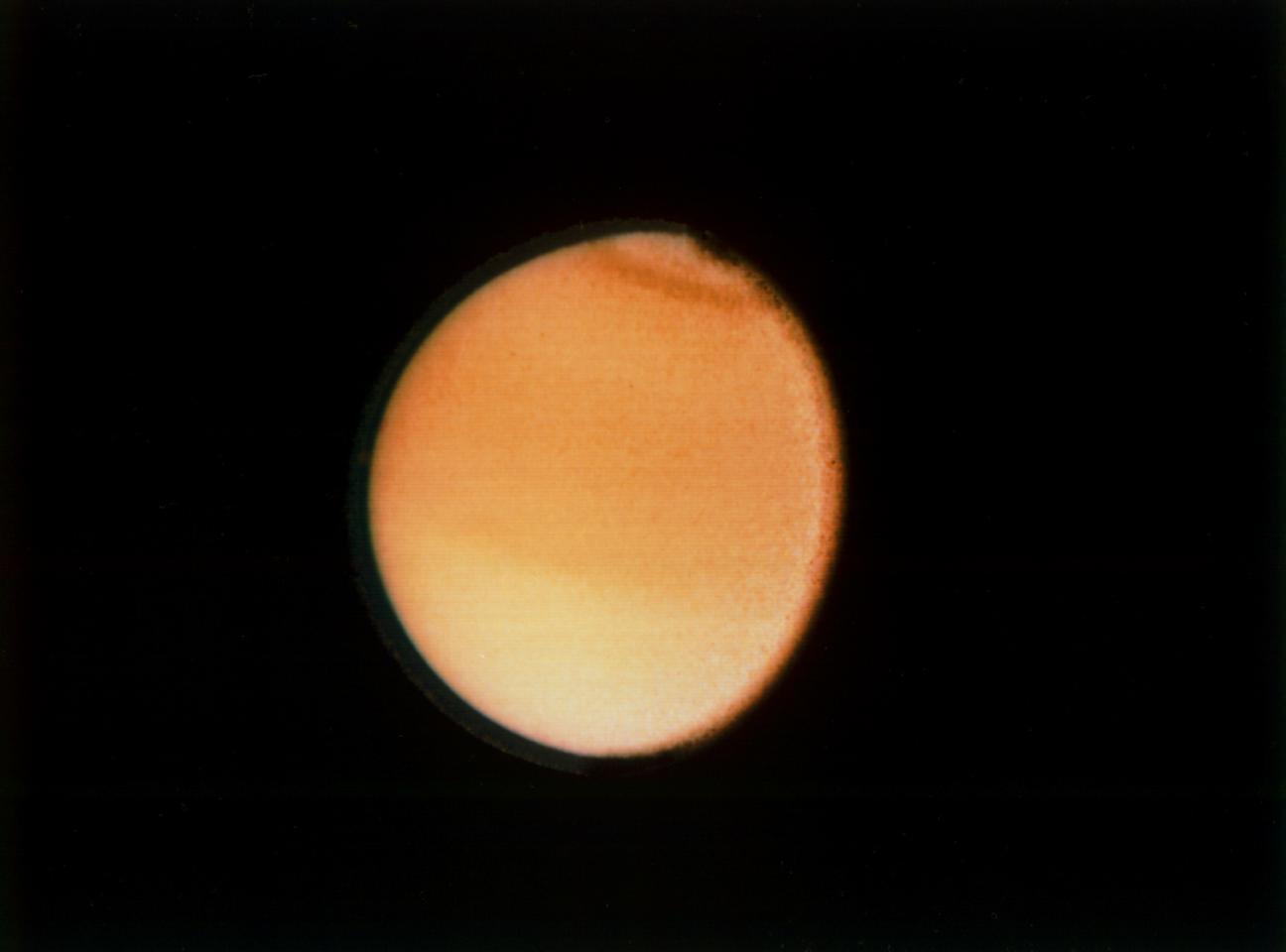
The three views presented in this table correspond to
images acquired from the Voyager 1 probe and the Voyager 2 probe during
their flyby of the System of the Gas Giant Saturn. The view shown in the
upper part of the table which reveals the upper part of Titan's hazy
atmosphere was obtained from the Voyager 1 spacecraft on November 12, 1980
at a distance of 22,000 kilometers or 13,700 miles from the Orange Moon.
The second view from top also unveils the upper part of Titan's opaque
atmosphere. The image was acquired from the Voyager 1 probe on November
12, 1980 at a distance of 435,000 kilometers or 270,000 miles from the
giant moon. The image shown in the lower part of the table unveils the
orange disk of Titan. One can notice that the atmosphere is not completely
uniform since the northern hemisphere appears darker than the southern
hemisphere. One can also observe a dark collar in the north polar region.
The image was captured from the Voyager 2 spacecraft on August 23, 1981 at
a distance of 2.3 million kilometers or 1.4 million miles from the Opaque
Moon. The view was generated on the basis of blue, green and violet frames.
Credit for the first view from top:
NASA/JPL/Voyager 1. |
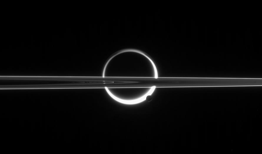
The image above shows a portion of the rings of Saturn,
the disk of Saturn's largest moon Titan and the disk of the icy moon
Enceladus. The snapshot was obtained in visible red light with the
Narrow-Angle Camera of the Cassini probe on June 10, 2006 at a distance of
about 3.9 million kilometers or 2.4 million miles from the active moon
Enceladus and 5.3 million kilometers or 3.3 million miles from the Opaque
Moon Titan. The image was acquired at a Sun-moon-probe, or phase, angle of
approximately 160 degrees relative to the giant moon Titan and the tiny
moon Enceladus. A significant portion of Saturn's rings, Titan or
Enceladus is in the dark due to the high phase angle. One can notice the
opaque and hazy atmosphere of Titan as well as the icy jets of Enceladus
thanks to the solar radiations which are scattered by the atmosphere of
Titan or the icy plumes of Enceladus. One can also guess the surface of
Titan in this remarkable crescent reminiscent of a solar eclipse. Image Credit: NASA/JPL/Space Science Institute. |
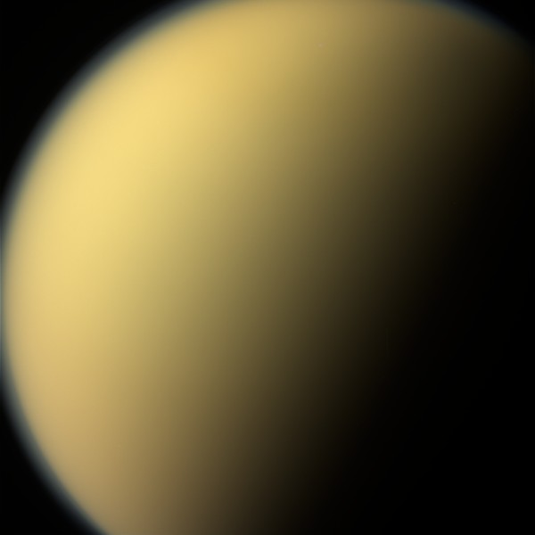
The image in the upper part of this table unveils the
last radar data and altimetry data of Titan's surface obtained from the
Cassini orbiter during its mission in the Saturn System. These radar data
and altimetry data were acquired with the Radar Mapper of the Cassini
spacecraft during the 127th targeted flyby of the Orange Moon performed on
April 22, 2017 and called T-126. The Radar Mapper captured two radar views
of Titan's surface presented in Figure A. Each portion is about 200 miles
or 300 kilometers long. The radar view at right clearly shows a portion of
a sea or a lake of hydrocarbons. Lakes or seas appear relatively dark and
uniform. Brightness variations allow us to discern topographic or
landscape features. Landscape elements will appear bright if they are
rough, irregular or tilted toward the orbiter. On the other hand,
landscape features which are smooth like lakes, seas, plains or plateaus
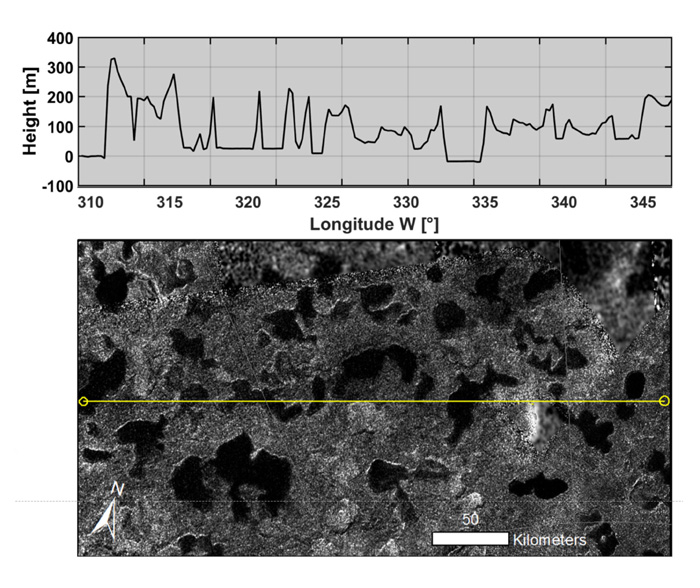
will appear dark as opposed to mountains or hills. The radar view found on the left part of Figure A reveals a portion of Titan's landscape which had already been observed during the first radar flyby of the Opaque Moon in 2004. One can notice bright, hilly terrains as well as darker plains. Planetologists are in a position to advance that there are no obvious evidence of changes in the appearance of the terrain in this area from the first radar view in 2004 to the final radar view of 2017. The radar view found on the right part of Figure A clearly shows the portion of the lake or sea Ligeia Mare where a transient bright feature called the "Magic Island" had been identified in several radar views during the Cassini mission. Was the Magic Island a transient island close to the coast ? The last radar view shows that the Magic Island is completely absent. It seems to have completely disappeared. Several hypotheses have been advanced to account for the presence of the enigmatic transient feature. It may have been related to a field of bubbles or strong waves. The lower view of the image represents Figure B which reveals altimetry data in a region of lakes in the middle of both radar portions presented in Figure A. Altimetry data were obtained during the T-126 Flyby thanks to the Radar Mapper of the Cassini probe which switched to altimetry mode in order to perform a first-ever or last-ever measurement of the depths of several lakes that are located in the north polar region of Saturn's largest moon. The Cassini orbiter had to orientate its antenna straight down at the surface. Thus, the Radar Mapper measured the time delay between echoes from the surface of the pool of liquid and echoes from the bottom or floor of the lake. The graph of Figure B indicates variations in the depth, altitude or height of the terrain where the altimetry signal was sent. The radar view found in the lower part of Figure B corresponds to a radar portion of the area acquired during a previous radar flyby of the region where this altimetry campaign was performed. The yellow segment shows the area where the altimetry data were taken. Thus, we obtained altimetry data for eight small lakes located in the north polar region of Titan. Although the altimetry data are still preliminary, the lakes whose topography has been studied here are believed to be approximately the same depth. The small pools of hydrocarbons may be about 100 meters or 328 feet deep. Are those lakes connected to a subsurface layer of liquid hydrocarbons comparable to a water table or aquifer ? That's a question researchers are seriously considering, at least for the north polar region of the giant moon. The second view from the upper part of the table corresponds to Figure A in higher resolution and the third view from the upper part of the table represents Figure B in higher resolution as well. Image Credit: NASA/JPL-Caltech/ASI. |
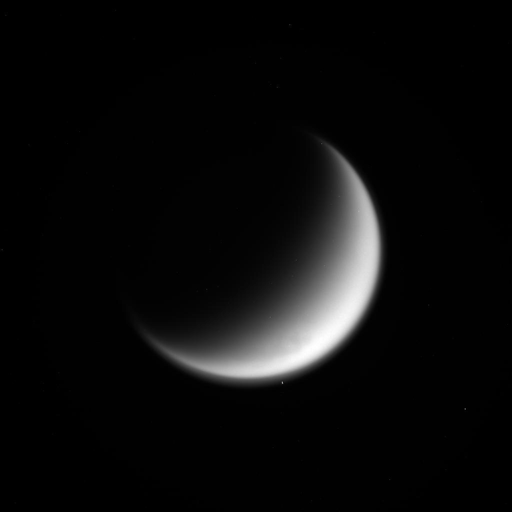
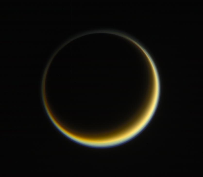
The view above shows the disk of Saturn's largest moon
with a dark portion and a rough crescent related to the orientation of
solar radiations which come, to a certain extent, from the other side and
which clearly reveal the blue upper layer of the complex atmosphere of the
Orange Moon. The image corresponds to a natural-color view generated on
the basis of photos acquired with the Narrow-Angle Camera of the Cassini
orbiter on May 29, 2017 using red, green and blue spectral filters. The
final image was obtained at a distance of about 1.2 million miles or 2
million kilometers from the Opaque Moon. Titan experiences long nights
because its rotation relative to the Sun is long. The contrast between the
orange tint which dominates the hazy atmosphere of Titan and the blue tint
which dominates the upper atmosphere is remarkable. Researchers advance
that the difference in color could be related to a difference in the size
of the particles in the haze. The blue haze dominating the upper
atmosphere may be composed of smaller particles or compounds than the
orange haze. The geometric configuration, here, between the spacecraft,
Titan and the Sun, unveiling an interesting viewing angle, allows us to
notice captivating features of Titan's atmosphere which is complex, deep,
thick and rich in hydrocarbons or organics. Image Credit: NASA/JPL-Caltech/Space Science Institute. |
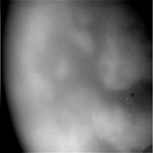
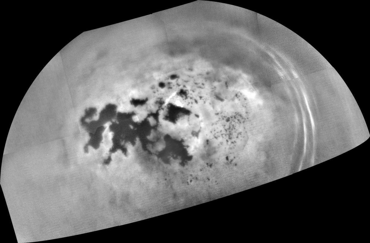
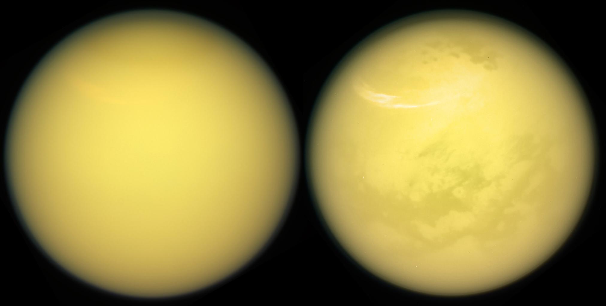
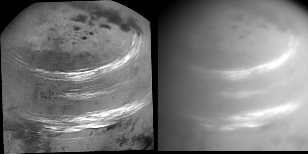
The views above unveiling the disk of Titan, clouds and surface features were taken on March 21, 2017 with the Narrow-Angle Camera of the Cassini orbiter. Images acquired using red, green and blue spectral filters were combined to generate the natural color view appearing on the left. The image of Titan's disk appearing on the right was generated by substituting an infrared view sensitive to wavelengths of 938 nanometers for the red color channel. The images of Saturn's largest moon were captured at a distance of about 613,000 miles or 986,000 kilometers from the Orange Moon. The Cassini spacecraft has several instruments which can see through the hazy atmosphere. One can discern surface features via the Radar Mapper which produces radar views of the lakes, seas, rivers, plains, hills or mountains. One can also analyze the landscape on the basis of images taken with the Visual and Infrared Mapping Spectrometer or VIMS. The infrared or near-infrared images unveil surface features and brightness variations. We've mapped almost the entire surface of the giant moon thanks to radar and near-infrared or infrared data obtained from the Cassini spacecraft. Atmospheric features such as cyclones, dynamic clouds or cirrus-like clouds have been observed or monitored in the Titanian atmosphere during the Cassini mission. The right view clearly shows bright elongated clouds in the high latitudes of the northern hemisphere as well as pools of liquid hydrocarbons in the north polar region. Image Credit: NASA/JPL-Caltech/Space Science Institute. |
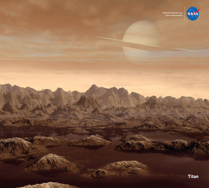
The image above represents an artist's impression of Titan's landscape in the land of lakes and seas. The pools of liquids on Titan are likely dominated by methane and may also contain ethane and dissolved nitrogen. From the surface of the giant moon, the disk of Saturn would appear much larger than the disk of our moon observed from the surface of the Earth. However, the atmosphere of Titan is hazy and opaque in the visible spectrum. Therefore, Saturn may not be discernable from the surface of Titan with our eyes. Are there complex organics in the land of lakes, seas and rivers ? Image Credit: NASA/Jet Propulsion Laboratory-Caltech. |
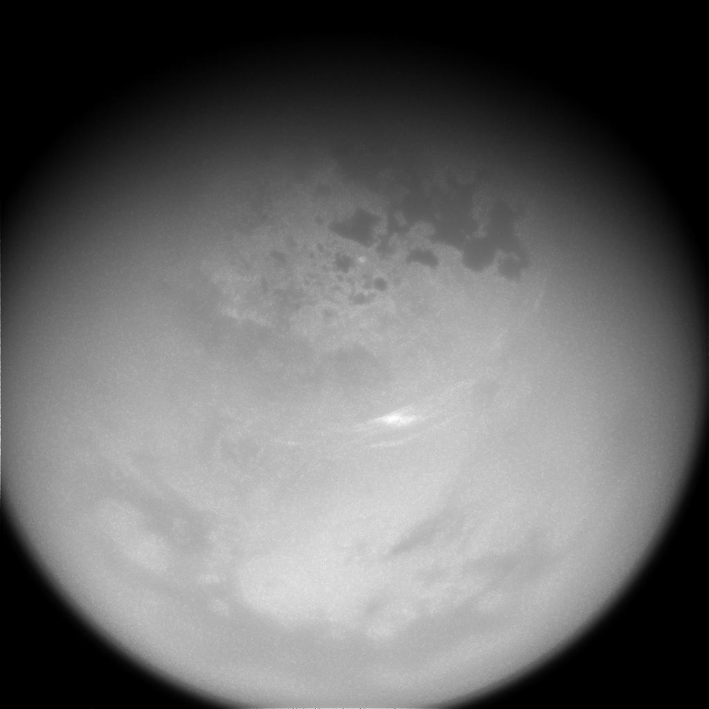
The image above reveals, in particular, the land of lakes
and seas in the high latitudes of Titan's northern hemisphere. One can
also notice the dark low-latitude areas dominated by Seif Dunes as well as
bright, elongated methane clouds drifting around the north polar region.
Seas and lakes on Titan are likely composed of a mixture of methane and
ethane. Methane is the second most abundant compound of the atmosphere of
the Opaque Moon. The Titanian atmosphere is dominated by nitrogen like the
atmosphere of the Earth. The view was obtained from the ISS Narrow-Angle Camera of the Cassini spacecraft on June 9, 2017 with a spectral filter sensitive to wavelengths of near-infrared radiations centered at 938 nanometers. The image was captured at a distance of approximately 315,000 miles or 507,000 kilometers from the Orange Moon. The northern hemisphere and the area of Kraken Mare have now entered the Summer season since the Solstice of May 24, 2017 which also marks the beginning of the Winter season in the southern hemisphere. Most high-latitude regions in the northern hemisphere are now illuminated by the Sun. Image Credit: NASA/JPL-Caltech/Space Science Institute. |
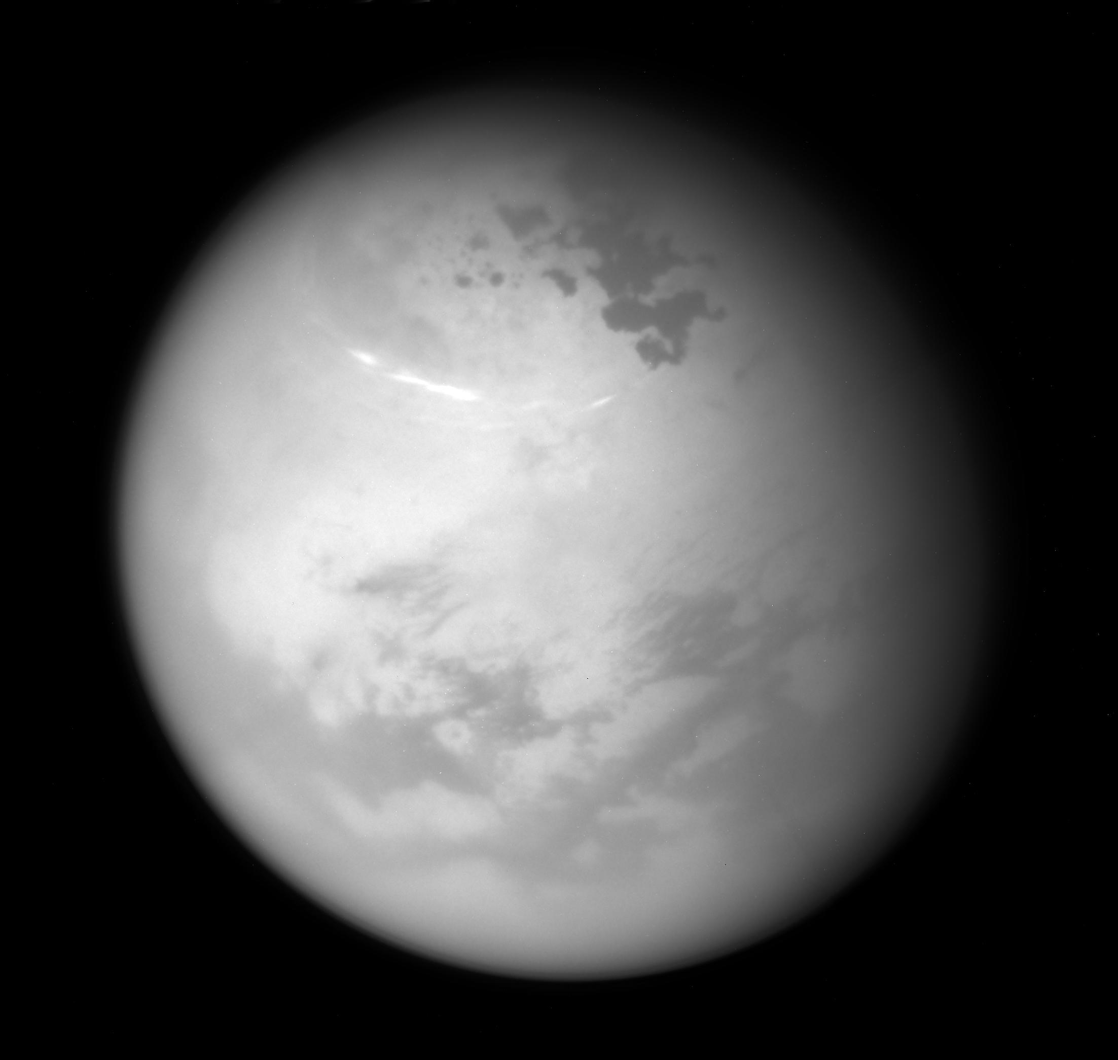
The image above, obtained on May 7, 2017
from the Imaging Science Subsystem (ISS) of the Cassini spacecraft,
reveals several large, elongated cloud systems in the northern hemisphere
of the Opaque Moon Titan. The view which was acquired at a distance of
311,000 miles or 500,000 kilometers represents an orthographic projection
centered on 37.5 degrees north latitude and 45 degrees west longitude. An
orthographic image is roughly similar to the view seen by a distant
watcher. Planetologists had anticipated a rise in cloud activity in the
high latitudes of the northern hemisphere since the Summer season in the
northern hemisphere is about to start in less than a month. The seasonal
change implies an increase in the level of solar radiation reaching the
north polar region of Titan. As a result, the level of evaporation in the
high latitudes of the northern hemisphere may rise leading to the
formation of new clouds with a higher level of cloud activity. Image Credit: NASA/JPL-Caltech/Space Science Institute. |
The view in the upper part of
this table unveils several elongated cloud systems drifting across the
northern hemisphere of Saturn's largest moon Titan. The image was acquired
from the Cassini spacecraft on May 7, 2017 at a distance of 316,000 miles
or 508,000 kilometers from the Opaque Moon. The photo corresponds to an
orthographic projection centered on 57 degrees north latitude and 48
degrees west longitude. The orthographic image is roughly similar to the
view obtained by a distant observer. Surface and cloud features on Titan
can be clearly observed or identified in the infrared or near-infrared
spectrum. The clouds, revealed here, are apparently composed of methane. Image Credit: NASA/JPL-Caltech/Space Science Institute. |
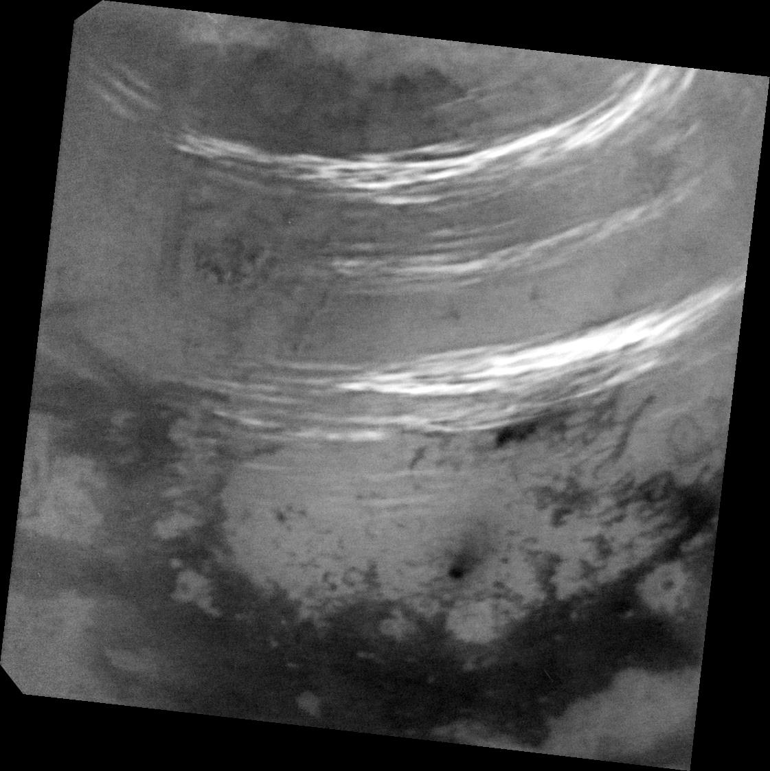
The three images of this table correspond to raw views or
unprocessed images of Saturn's largest moon Titan obtained from the
Cassini spacecraft during the final close flyby of the Opaque Moon on
April 21, 2017. From outer space, one can notice surface features on Titan
in the infrared or near-infrared spectrum. The Titanian atmosphere appears
completely opaque in the visible spectrum. The relatively dark areas found
at low latitudes are dominated by Seif Dunes. Lakes, seas and rivers turn
out to be concentrated in the high latitudes or in the polar regions of
the Orange Moon. In the upper view, one can notice the dark regions of
Fensal and Aztlan. Are Fensal and Aztlan the remnants of ancient seas of
liquid methane or liquid ethane ? How can we explain the dichotomy in the
distribution of surface liquids between the south polar region and the
north polar region or between the low latitudes and the high latitudes ?
Is the hazy atmosphere of the giant moon stable over time ? Credit for the images: NASA/JPL-Caltech/Space Science Institute. |
This image corresponds to a mosaic view revealing the
lakes and seas located in the high latitudes of the northern hemisphere of
Saturn's largest moon Titan. The images used to assemble this mosaic view
were obtained on February 17, 2017 from the Narrow-Angle Camera of the
Cassini probe during a relatively distant encounter with the Opaque Moon
as the spacecraft was speeding away from Titan. The image was acquired at
a distance of about 150,700 miles or 242,500 kilometers from the giant
moon. The views were captured with a spectral filter sensitive to
wavelengths of near-infrared radiation centered at 938 nanometers. At this
wavelength, one can see through the opaque atmosphere of Titan and discern
landscape features, lakes, seas and even clouds. The image represents an
orthographic projection centered on 68 degrees north latitude and 225
degrees west longitude. An orthographic image is roughly similar to the
image seen by a distant watcher observing with a telescope. The mosaic view clearly shows the land of lakes, seas and rivers found in the high latitudes of the northern hemisphere. Kraken Mare, Ligeia Mare and Punga Mare can be clearly discerned here. One can notice several prominent cloud streaks evolving at mid-latitudes between 45 and 55 degrees north latitude to the right of the image. A bright cloud patch can also be identified in the area of the lake or sea Punga Mare found to the right of Kraken Mare roughly at center. During this distant encounter, the viewing angle over Kraken Mare and its neighboring pool of liquid hydrocarbons Ligeia Mare appeared better than during previous flybys with a higher contrast so that more details could be discerned regarding landscape features and the shorelines or the boundaries of the surface bodies of liquid. The solar radiations had to go through less haze to reach the lakes or seas and to bounce toward the eye of the Cassini spacecraft. That's why the quality of the image appeared better this time than during previous passes. This encounter represented one of several "non-targeted" passes of the Opaque Moon in 2017 that enable researchers to monitor and analyze cloud activity in the high latitudes of the northern hemisphere. The engineers did not have to use rocket-thruster firings to orientate the probe for this flyby. The Spring season in the northern hemisphere is about to end and the Summer season in the northern hemisphere is approaching. Does this period of transition imply significant changes in cloud activity in the north polar region ? Probably because researchers are now observing increasing cloud activity in the north polar region. However, some models regarding Titan's meteorology or atmosphere had predicted more cloud activity than what scientists currently observe. Image Credit: NASA/JPL-Caltech/Space Science Institute. |
The image above reveals, in particular, several elongated
cloud patches evolving around the north polar region of Saturn's largest
moon Titan. One can also notice the famous land of lakes and seas which
appear relatively dark and uniform in this view. Titan's northern
hemisphere is now experiencing the end of the Spring season. The long
Summer season in the area will start very soon during the year of 2017.
The lakes, seas or rivers may be mainly composed of methane, a simple
hydrocarbon. The wispy clouds appear at high altitudes and at high
latitudes. Researchers have noticed an increase in the amount or in the
concentration of clouds in the area but they had expected the development
of more clouds or larger cloud formations in this seasonal configuration.
The sky of the Opaque Moon in the high latitudes of the northern
hemisphere is surprisingly clear in this period of the Titanian year.
Clouds are remarkably dynamic or sporadic. Researchers try to regularly
monitor the atmosphere or the meteorology of Titan in order to have a
correct insight into the level of cloud activity. Are the amount of clouds,
the concentration of clouds or the distribution of clouds in line with the
predictions of the prevailing meteorological model of Titan ? The view was acquired with the Narrow-Angle Camera of the Cassini probe on October 29, 2016 using a spectral filter sensitive to wavelengths of near-infrared radiation centered at 938 nanometers. The camera is orientated toward the Saturn-facing side of the Hazy Moon. North appears upward and is inclined 3 degrees to the left. The image of Titan's disk was taken at a distance of about 545,000 miles or 878,000 kilometers from the Opaque Moon. The infrared or near-infrared views allow us to discern surface features as well as clouds. One can also notice in this view the dark low-latitude areas which tend to be dominated by Seif Dunes or parallel and linear dunes extending over long distances under the influence of prevailing winds. Image Credit: NASA/JPL-Caltech/Space Science Institute. |
Titan Images 2016
Titan Images 2015
Titan Images 2014
Titan Images 2013
Titan Images 2012
Titan Images 2011
Titan Images 2010
Titan
Images 2009
Titan
Images 2008
Titan
Images 2007
Titan
Images 2006
Titan
Images 2005, 2004