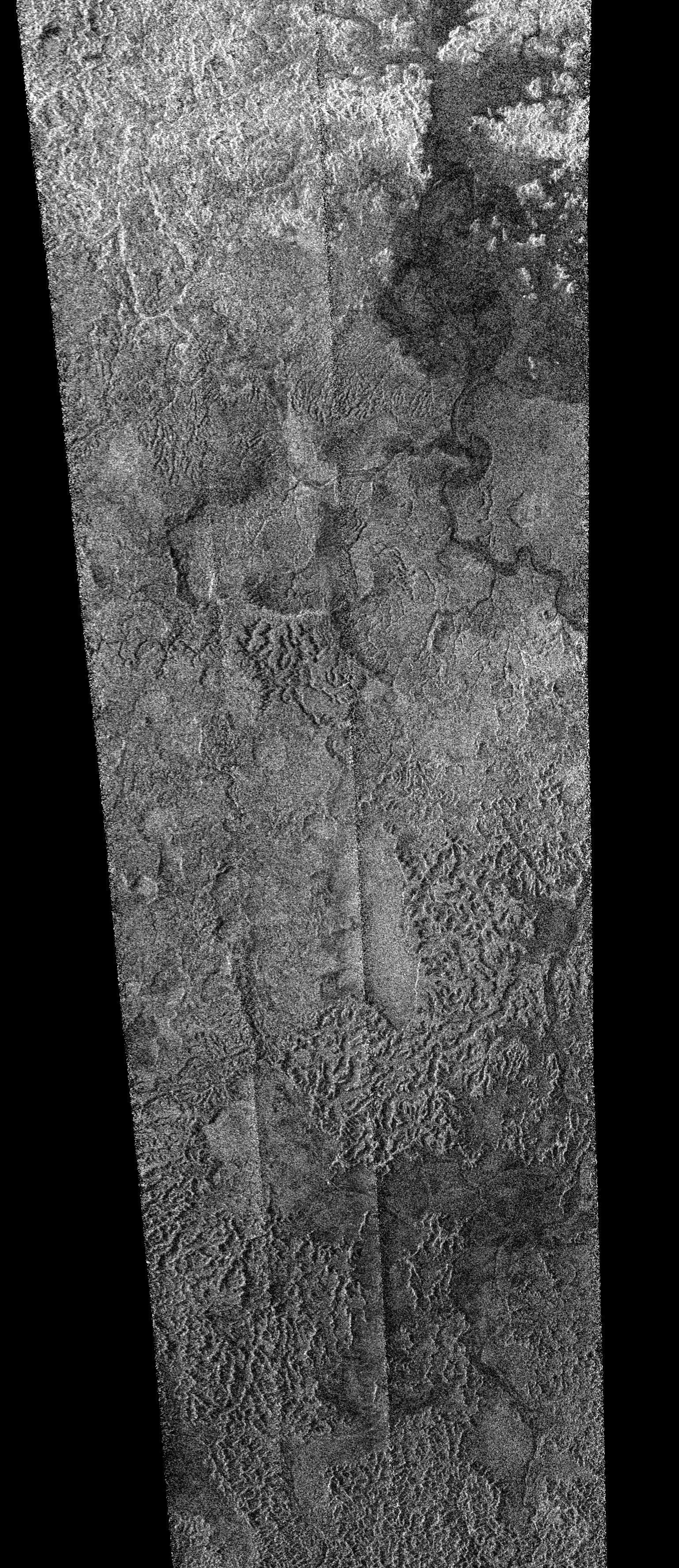
Titan Artistic Views
 |
|
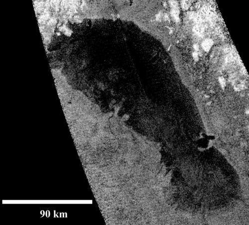
Radar Image credit: NASA/JPL-Caltech |
Note: The arrow was incorporated into the radar portion showing the weird bay of Ontario Lacus to indicate the area represented in the artistic image. |
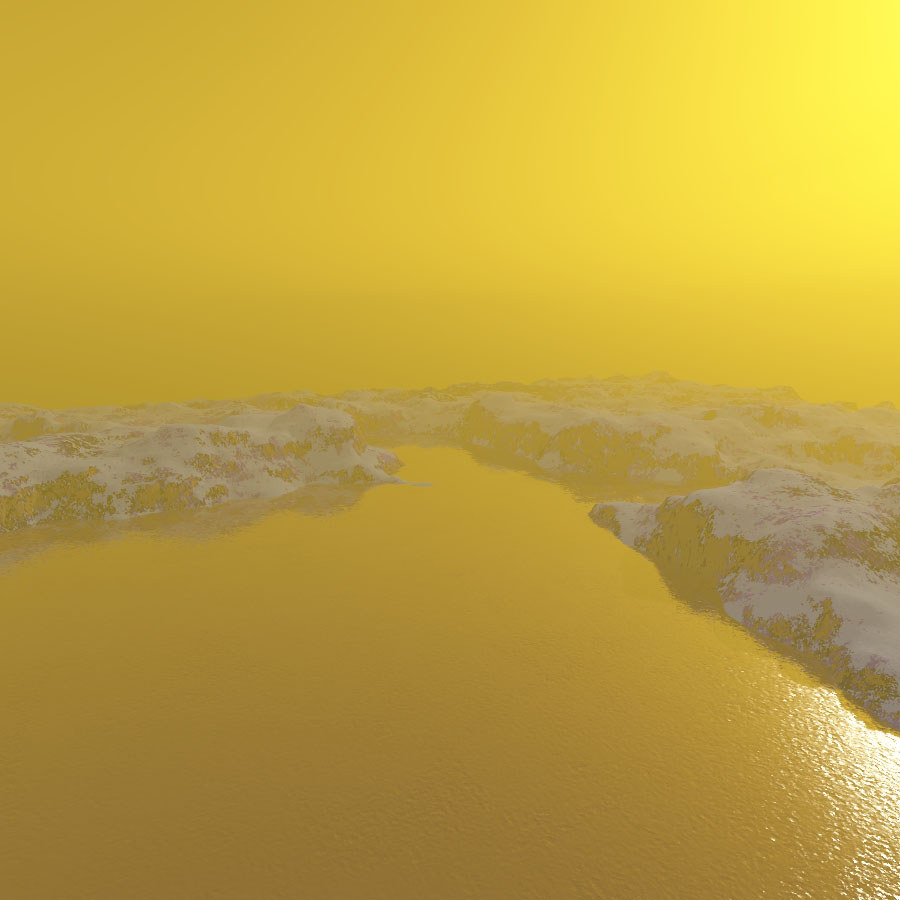
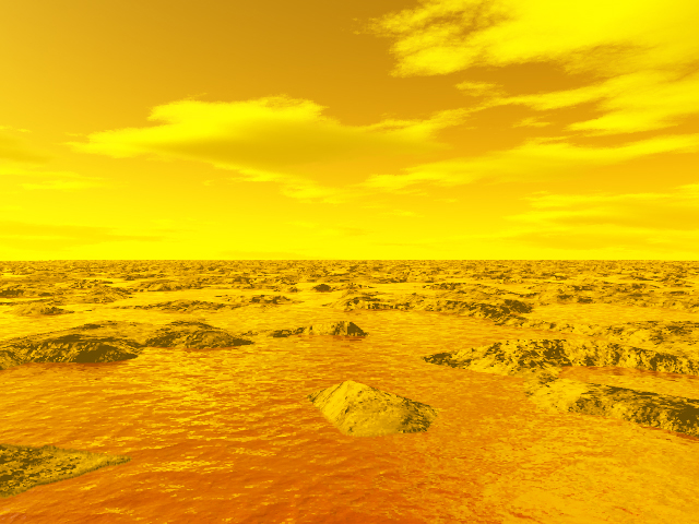
The computer-generated
image, in the upper part of the table above, unveils a surprising
bay in the eastern shoreline of the largest pool of liquids in
the south polar region. The kidney-shaped lake, approximately 235
km long and 15,000 square kilometers or 6,000 square miles in surface
area is called Ontario Lacus. The lake is, probably, mainly composed
of methane, ethane and propane. © All Rights reserved, Marc Lafferre, Artistic View of an Intriguing Bay in Ontario Lacus, Year 2010 |
|
 |
|
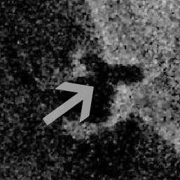
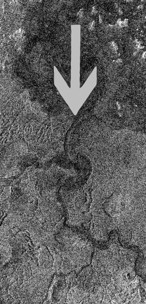
Image Credit: NASA/JPL |
Note: The arrow was incorporated into the radar portion showing the delta of Mezzoramia to indicate the area represented in the artistic image. |
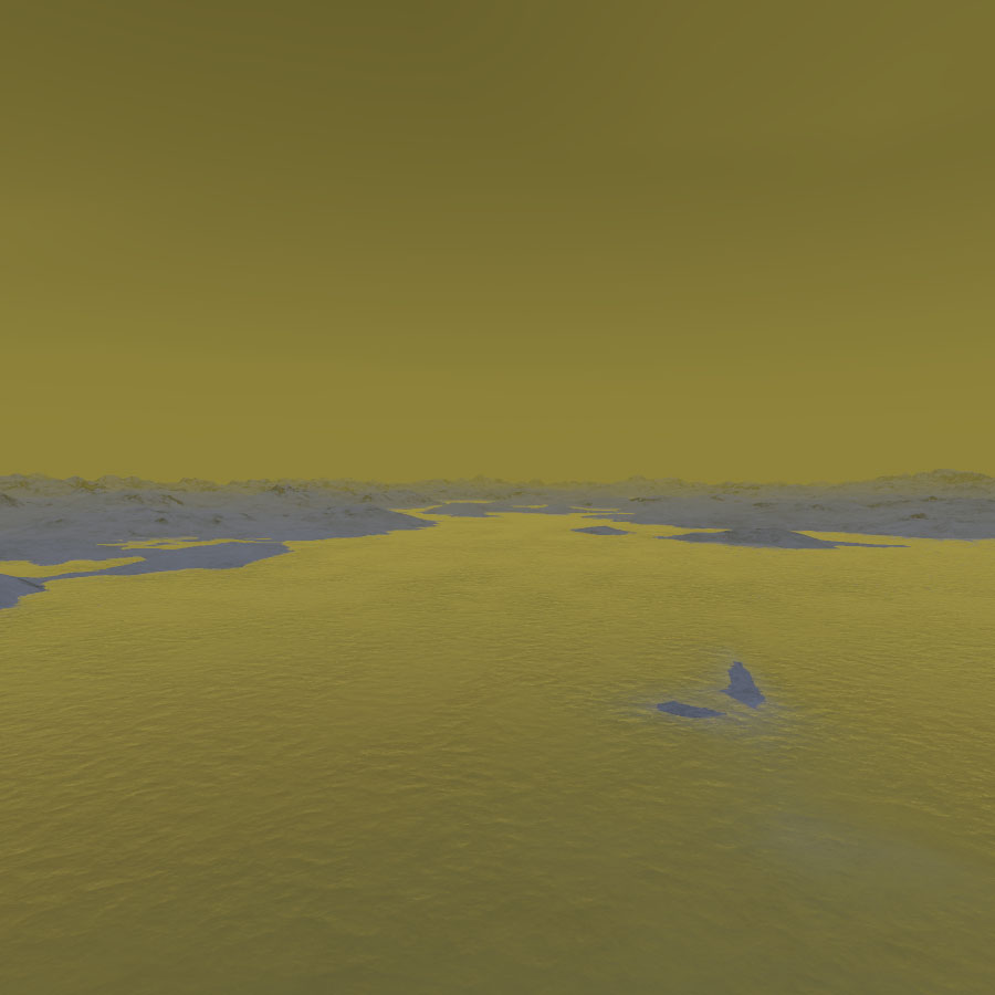
| The « artistic » simulation
view, above the radar images taken with the radar mapper of the
Cassini spacecraft, represents a delta or estuary of Mezzoramia, an
optically-dark
patch
in the south polar region of Saturn’s largest moon ,Titan. The
image shows an area located at about 73 degrees south latitude and 30
degrees west longitude. The image was generated on the basis of a radar portion of the south-west of Mezzoramia acquired with the Synthetic Aperture Radar instrument of the Cassini spacecraft on December 20, 2007. The radar view was first retrieved, reprocessed with a photo editor in order to partially remove the noise related to the relatively low resolution of the radar image. The portion of the radar swath was then incorporated into a landscape generator which produces landscapes depending on the brightness variations of the radar view. The view is based on the assumption that the hills are no higher than 200 meters (600 feet). Currently, the dark patch of Mezzoramia is thought to be partially filled with liquid methane or ethane. Since the Winter Solstice in the southern hemisphere is approaching (Winter will start in May 2017), it is likely that Mezzoramia will progressively fill with liquid hydrocarbons. The snapshot is supposed to be taken in the winter period. The radar swath of December 20, 2007 clearly shows a dark drainage channel connected to the south-west portion of the dark Mezzoramia. This sinuous drainage channel runs southward, over a distance of about 300 km or 190 miles, to the eroded region of Sikun Labyrinthus, a complex and rugged terrain made of hills and dendritic canyons, reminiscent of karstic regions on Earth. The delta of Mezzoramia appears to be approximately 10 km or 6 miles wide. The artistic simulation takes several parameters into account: the luminosity reaching the soil is particularly weak and the Sun is low on the horizon. Moreover, the sky is not perfectly clear due to a dense haze. The hills are dominated by reflective materials such as water ice or frozen carbon dioxide. The relatively low density of liquid methane and ethane prevents water ice from floating on that liquid. © All Rights reserved, Marc Lafferre, Artistic
View of the Delta of Mezzoramia, Year 2010 |
|
 |
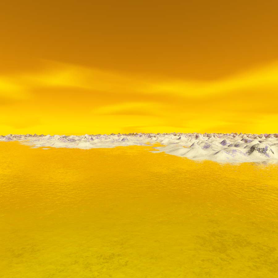
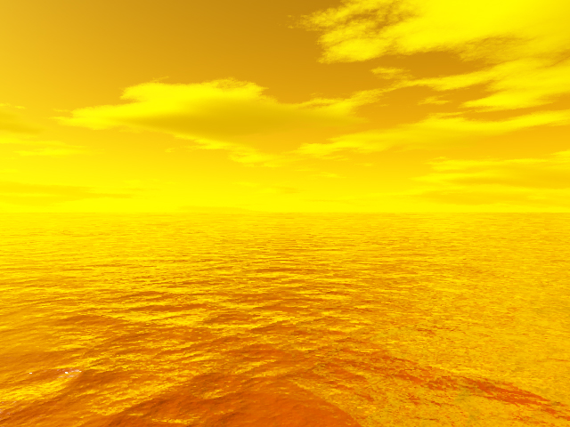
This Titan artistic view shows
one of the lakes in the surroundings of the giant south polar Lake
"Ontario
Lacus". The area
is currently in the summer season that is about to come to an end.
This extra-terrestrial pool probably consists, mostly, of liquid
ethane according to the spectral analysis
of latest data. © Marc Lafferre, Artistic View, Year 2008 |
 |
|
The computer-generated
image above unveils the coastline of a bay from one of the largest
bodies of liquid in Titan's
north
polar region. It was obtained with the landscape generator
Terragen on the basis of a radar portion captured by the Cassini
spacecraft during the 31st Titan flyby ( T30 ) on May 12, 2007. © Marc Lafferre, Artistic View, Year 2008 |
Radar Image Source: NASA, JPL |
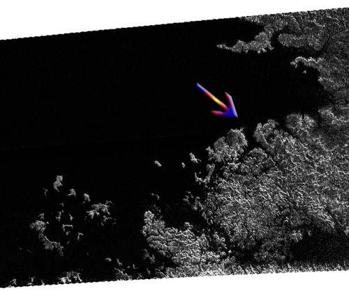
 |
© Marc Lafferre, Year 2006 The image above represents a wet area of Titan in the Saturn facing hemisphere at high latitudes towards the south pole. It is currently summer and the region is in a rainy period. It has just undergone what is comparable to a tropical storm on Earth. Due to the little amount of solar energy received, the process of cloud formation is very slow. But when the clouds reach a certain point of mass and density, they release the hydrocarbon compounds in a very sudden way as speculated Ralph Lorenz ( monsoon events). The high concentration of methane in Titan's atmosphere, especially near the soil, suggest that Titan seas, lakes or oceans are made up of methane. Nevertheless, Titan harbors a complex organic chemistry which involves other hydrocarbon molecules such as ethane, acetylene, hydrogen cyanid, etylene and more complex hydrocarbon constituents. Hence, the possibility of an ethane sea has been advanced and it can't be ruled out at today's point of knowledge. |
 |
© Marc Lafferre, Year 2006 The image above represents "Ontario Lacus", a giant lake spotted in Titan's south pole by the VIMS ( Visual and Infrared Mapping Spectrometer ) onboard the Cassini spacecraft. This lake or sea is around 230 km long. As the south pole is currently tilted towards the Sun ( Summer period ), the region absorbs a relatively high amount of energy compared to the winter hemisphere ( northern hemisphere ). As a result, the evaporation process of organic compounds ( methane, ethane or acetylene) is higher. And this phenomenon explains well the presence of the cloud formations identified in the south pole by the infrared camera of the Cassini probe. It is very likely that Ontario Lacus is a primary source for those rapidly dissipating formations of clouds. |
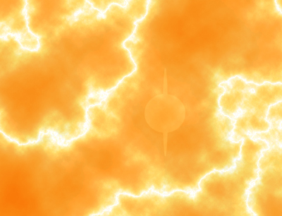 |
Lightning on Titan This rendering shows flashes of lightning on Titan lowering the opacity of the atmosphere so that the disk of Saturn can be briefly seen through the red haze from the surface of Titan.For a Titanian observer, Saturn appears 11 times larger than the Moon of the Earth as seen from the surface of our planet and Saturn is also much more reflective than our moon with an albedo close to 50% compared to an albedo of 12% for the Satellite of the Earth. Image Source: Marc Lafferre, year 2005 |
If you have any comment to bring or any artistic image of Titan to submit to us, please send us the e mail at the following web address: titanteammlgc@yahoo.com or fill in the form below ( for the form, the size of the file should not be over 200 ko ).